13 Inches — Really??
Stowe and Jay got more than a foot of snow last night, while nearby resorts only got an inch or two. Does that mean the Jay Cloud is real? Meteorologists explain.
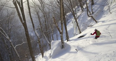
Sometimes, when you’re really lucky, the skies open up and blast more than a foot of unexpected snow all over your favorite mountain.
Last night, that’s what happened for Jay Peak and Stowe Mountain Resort. Bolton Valley got 3 inches and Burke Mountain Resort got 2. Smugglers’ Notch, just 4 miles from Stowe as the crow flies, got 2 inches. But somehow, Jay reported a total of 13. Stowe got 12 on the upper half of the mountain, according to Scott Braaten, Stowe Mountain Resort’s weather guru.
This begs the question: how can a storm be so localized that it hits Stowe and Jay, but nowhere else?
To find out, we consulted local weather expert Roger Hill, who puzzled out the atmospheric conditions that caused the storm.
“It was localized, and it was terrain-induced, but typically that’s caused by cold air induction,” he said. “This was the opposite, so I’m a little stumped. It’s a bit of a research project.”
It could have been caused by a lake-effect from Lake Champlain, or even Lake Ontario. “It was some sort of low-level mechanism—when I say low-level I mean 2,500 to 7,000 feet—that was interacting with moisture as the warmer air was coming in,” he said. “It had to interact with the local terrain, so it had to be relatively low down.”
For reference, the temperature change in Stowe on Jan. 2 was 39.3 degrees: the low was -22.8, and the high was 16.5. That’s the same change as a 30-degree morning morphing into an almost 70-degree afternoon.
Based on predictable weather patterns, forecasters know that certain areas of Vermont are more likely to get snow than others. The ‘Jay Cloud’ is credited with blessing Jay Peak and its surroundings with a surplus of 100 inches per year, compared to other ski areas. Jay claims an average of 349″ of natural snowfall per season, while Mount Mansfield, Vermont’s highest peak, gets about 243″. In 2007-2008, Jay received 423 inches. To put that in perspective, in 2015-16 Alta, Utah, logged 438 inches for the same season.
Some meteorologists snicker at the prospect of the Jay Cloud, but others see it as fact. Andy Nash, a meteorologist with the National Weather Service in Burlington, says: “The way the mountain is oriented along a northeast-southwest line places it perfectly perpendicular to the northwest winds that we get a lot in winter.” Those winds hit the mountain, rise, clouds form, “and in winter, the snowfall adds up pretty quickly.”
While Jay, due to its northerly location, might get more than its share of snow, the “cloud” affects all of the Green Mountains. Winds pick up some of Lake Champlain’s moisture before condensing into cloud form. When those clouds hit the mountains, they release their snowy contents onto the slopes.
“All the ski areas get a decent amount of snow from these upslope events,” says Scott Braaten, Stowe’s snow reporter. “But that phenomenon is really concentrated from Sugarbush to Jay Peak.”
Braaten says it’s possible that something as localized as the Jay Cloud could exist, but in reality, it’s more spread out than that.
“I would term it the ‘Green Mountain Spine Cloud,’” he said. “Sugarbush, Mad River Glen, Bolton Valley, Stowe, Smuggler’s Notch and Jay Peak are all well-known for their snowfall. Sometimes if it starts snowing hard at Stowe, we say ‘the Jay Cloud got lost.’”
Southern Vermont gets its “cloud” too. Mountains to the south are more likely to see snow from a Nor’easter traveling north up the coast.
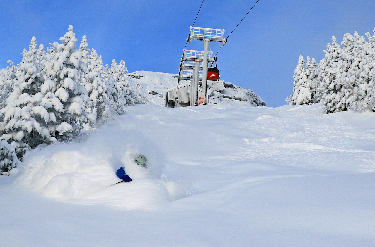
Story adapted from a print story in the Fall, 2016 issue titled “Is There Really A Jay Cloud’ or a Green Mountain Cloud?” Top photo: Jan. 3, 2018 at Stowe. Courtesy of Scott Braaten