What Could This Week’s Storm Deliver?
Snow is in the forecast for Vermont this weekend. The question is: how much will the mountains see from this storm?
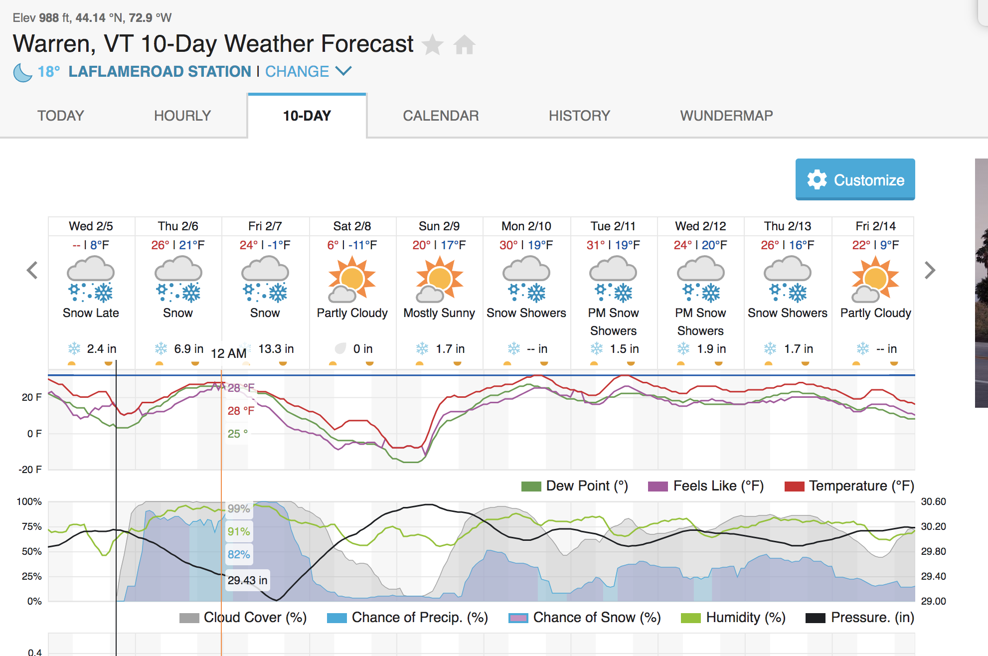
There’s been a lot of talk about a storm expected to hit Vermont early Thursday morning into Friday. With some outlets forecasting as many as 17 inches of snow in the valley and others calling for periods of freezing rain, it should bring an interesting end to the week and hopefully a powder day (or two).
On Wednesday afternoon, the National Weather Service announced a Winter Storm Warning effective at 4 a.m. on Thursday morning and extending until 10 p.m. on Friday night.
The warning was issued for central and northern Vermont, along with Northern New York. The National Weather Service issued a Winter Weather Advisory for Southern Vermont and New Hampshire, south of Route 4, and from the Southern Adirondacks southward in New York State.
Specifically, the warning applies to Caledonia, Addison, Chittenden, Franklin, Essex, Grand Isle, Lamoille, Orange, Orleans and Washington counties—leaving the potential for some fresh new snow at some of the state’s northern and centrally-located ski areas.
Snow is expected to fall over central and northern Vermont before daybreak on Thursday, leaving several inches in the valleys by morning. From there, the National Weather Service predicts that things are going to warm up a bit, bringing periods of light mixed precipitation later in the day and into Thursday night.
Then comes the next wave: on Friday, the snow is expected to return and become steady throughout the day, even becoming heavy at times (think one to two inches per hour) before it tapers off late Friday evening.
“Travel will be very difficult. The hazardous conditions will impact the morning commute on Thursday and both the morning and evening commutes on Friday,” reads the National Weather Service’s warning.
With colder snow expected Friday, the question is: will the warm period on Thursday bring mixed precipitation in the mountains or yield a dense snow that could replenish our snowpack?
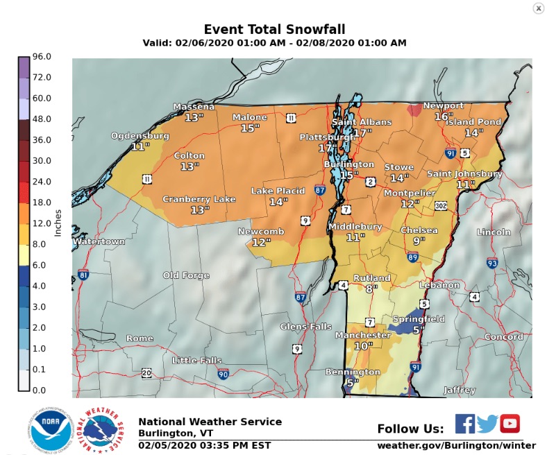
In a forecast issued Wednesday, WCAX predicted that the storm will drop a foot or more of snow in northern areas of the state, with 4 to 8 inches possible in southern counties. Southern Vermont may see some sleet and freezing rain, with “up to 1/10″ of icing possible.”
Scott Braaten of Braatencast issued his forecast Tuesday evening—calling for 7 to 12 inches of dense snow accumulation for the 48-hour storm total over the Northern Greens along the spine that runs from Sugarbush to Jay Peak.
The good news? Even if it’s likely to be wet, this storm may very well bolster our snowpack. Braaten was forecasting a snow water equivalent — a common snowpack measurement that essentially measures how wet a pocket of snow is — of 0.8-1.30″. Wetter snow is denser, and denser snow is good for building a strong base in the trees and backcountry.
“This will add a significant amount of frozen water to the snowpack, which is always good news for building natural depth,” he wrote. He predicts that, thanks to another area of low pressure expected to move into the region on Friday along with some colder temperatures, the mountains may see an additional 4-8 inches of snowfall by Friday afternoon.
You can find Braaten’s full forecast here.
Then, on Saturday, it’s going to get cold and clear, with temperatures falling to the single digits, according to WCAX’s forecast, by morning.
For the Mad River Valley, Josh Fox of The Single Chair Weather Blog called for precipitation to change to sleet late during the ski day on Thursday, even in the mountains—though not before the storm is expected to drop 4-6 inches of fresh snow.
“The critical question continues to revolve around the freezing rain issue; because, well, we’re skiers and that precipitation type can be very unkind to skiers,” said Fox in his Wed. Feb. 5 forecast. “Though sleet isn’t exactly powder and is certainly high on density, we can live with it and I’ve certainly made a few solid turns through it.”
However, he says, model data suggest that, with all of the air moving around the mountains associated with this storm, it may very well be that temperatures never rise above 40 degrees Fahrenheit at the summits of Mt. Ellen and General Stark Mountain.
However, all reports seem to indicate that the chance of ice certainly remains, with an increasing likelihood that Thursday’s precipitation will fall as snow as you move further north along the Green Mountain spine.
His forecast for Friday’s snow? 8-16 “mostly powdery” inches of freshies, followed by a crisp, clear day of post-storm skiing on Saturday.
In short? We’ll have to wait and see. But it seems highly probable that this weekend will bring some good skiing.
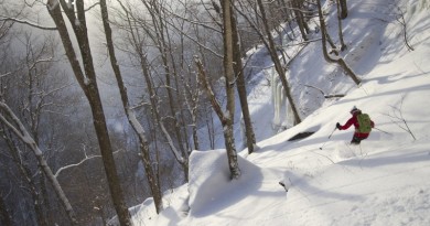
Featured Photo: Photo courtesy Mad River Glen. At Mad River Glen, the woods are already starting to look lovely, dark and deep.