Your Firetower Bucket List : 11 Hikes with Amazing Views
BY KRISTEN FOUNTAIN
Each fall, I hike Elmore Mountain. Last October, I was five months pregnant, but still went to climb the fire tower at the summit for the sweeping multi-hued view of the Green Mountains.
It was a weekday, mid-morning, crisp and sunny when I set out alone from Elmore State Park with two full water bottles. I decided I would go slowly and avoid the steep final section of the main trail to the summit by taking the slightly longer Ridge Trail for a 5.5-mile out and back.
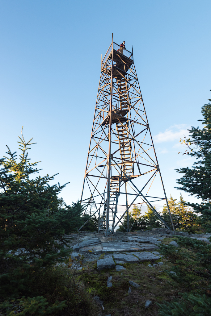
During my two-hour mosey, I was passed by two solo runners, one woman in Spandex with a waist pack full of supplies, the other a man loping by in basketball shorts and a collared shirt. There were also several couples, one with a friendly black lab. I was sure that all of us had the same goal: reach the 80-year-old crisscrossing metal tower that shoots 45 feet up above tree-line.
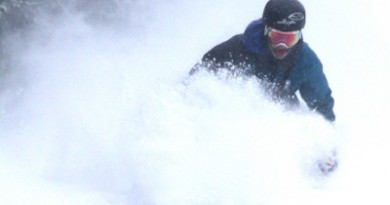
At the peak of fall, thousands of people climb mountains like Mt. Mansfield, Lincoln Peak or Killington— and there are few better places to see Vermont’s foliage than from the summit clearings. But if you want a different and more unique view of maples in flaming shades of red and orange, gold birches and mountain ash, hike to one of Vermont’s historic fire towers.
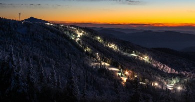
Located so as to maximize sight lines across the landscape, these old towers were designed to have immense views in all directions. Many are a short hike or drive from a ski area and some, such as the towers at Stratton and Okemo, are just off the summit lifts. Six (Bald, Burke, Elmore, Mt. Olga, Spruce and Stratton) are on the National Historic Lookout Register. Though no longer active, these towers once played a key role in preserving the forests and farmlands. In 1910, the state legislature gave the new state forest commission authority to post watchmen on peaks on private land. Droughts over the previous decade had led to record fires throughout New England’s forests. The idea was borrowed from Maine’s North Woods where the first tower system was built in 1905.
In Vermont, Camel’s Hump hosted the first lookout, who spent the 1911 season fully exposed to the elements. His work station was a cement table with a county map, a compass and a telephone were his only tools. Over the next several years, large landowners taxed themselves to construct towers and shelters from Bromley and Stratton Mountains in the south to Mount Carmel and Pico in the west, to Burke, Gore and West Pond Mountains in the Northeast Kingdom. Dozens more followed in the decade to come.
In that pre-satellite era, having two or more observation towers in close proximity was the key to triangulating a fire’s location. An observer would use an alidade, a stationary circular tool, to measure the angle between geodetic north and the fire. One tower’s measurement could identify the direction of the fire, but a second tower’s measurement is needed to determine how far the fire was from the first tower. Additional measurements from other towers would increase accuracy. Usually, a state forester would collect the reported measurements by telephone and plot the angles on a map. The fire was where all the lines intersected.
Between the 1930s and the 1940s, there were 38 fire observation towers inhabited by paid observers in every corner of the state. But by the end of the 1960s, Vermont, like other states, stopped building new fire towers and began allowing their existing ones to fall into disrepair. Small airplanes had become a more effective and less expensive way to track fires.
At the same time, big fires had become less common for several reasons, including changes in land use and forest management. Also, decades of successful fire suppression had changed the composition of the forest, making it less flammable. In particular, maples, birches and beeches—the trees that give Vermont its reputation for fiery foliage— had replaced red and white oaks. Oak leaves degrade slowly and provide perfect tinder.
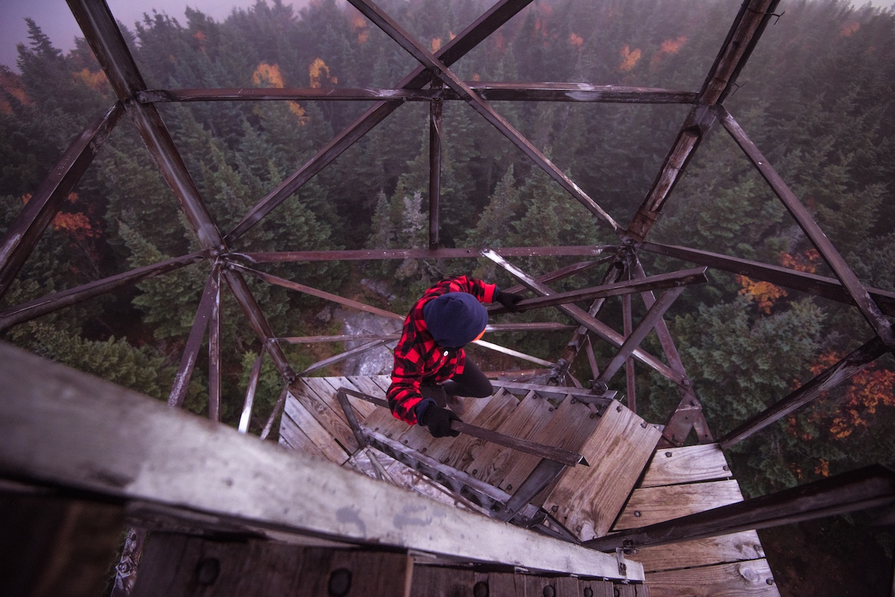
That fall day, at the top of the Elmore tower, I tried to imagine the life of an observer from decades past. The tower was built in 1939, a year after a hurricane had downed trees around the region, increasing the risk of fire. The watchman, or sometimes watchwoman, would have lived in a small nearby cabin for weeks at a time during the summer and fall. Every morning at daybreak, he would have climbed the flights of shaky metal grate steps to the perch in the cab.
As I climbed, the wind was just right, strong enough to ruffle the leaves but not so high as to make the tower rattle and sway. I thought of my daughter and how, one day, I’d bring her to the top as well, repeating the hike she made before she was ever born.
11 FIRE TOWER HIKES
Today, only 16 fire towers remain standing and at more than half, you can still climb the full five stories for spectacular views across the Green Mountains. For trails and maps, see vtskiandride.com.
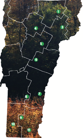 Bald Mountain (1) Not far from Burke, Bald Mountain is the tallest peak in the Lake Willoughby area and the third tallest in the Northeast Kingdom. A 2.1-mile (one way) hike on the Long Pond Trail will put you at the summit. From there, climb the restored fire tower for views north to Canada. Nearby, the non-profit Northwoods Center has restored one of the original lookout cabins which now serves as an overnight shelter and warming hut for visitors to Willoughby State Forest.
Belvidere (2) Halfway between Stowe and Jay Peak, the Long Trail crosses Belvidere Mountain. There are several routes up but from the trailhead parking on Route 118 it’s a 5.6 mile (and 2,000 vertical feet of elevation gain) to the summit.
Burke Mountain (3) Established in 1913, Burke Mountain is the second oldest lookout site in Vermont. The 54’ Aermotor tower with its 7’ x 7’ steel cab replaced a wooden tower that was blown down in the great hurricane of 1938. From Shelburne Lodge Road, hike the Red or the Blue Trail to the summit for views to Canada and Willoughby Gap.
Elmore Mountain (4) Elmore State Park, on the shores of Lake Elmore is about 10 miles north of Stowe. From the park, it’s about a 1.7 mile hike up the Fire Tower Trail to the summit. Look north from the fire tower and you can see Jay Peak and, to the south, Stowe’s Mt. Mansfield and Smuggler’s Notch’s Madonna mountain.
Spruce Mountain (5) East of the town of Barre, in Vermont’s first state forest, the L.R. Jones State Forest, there’s an easy 2.2-mile hike to a fire tower that has sat atop Spruce Mountain (3,037 feet) since it was moved here from St. Albans in 1944. Heading up, don’t miss the series of rock crevices and caves adjacent to the trail.
Bear Hill (6) You can actually drive to the base of the fire tower on Bear Hill in Allis State Park in Brookfield. Look for the stone walls that mark the boundaries of Wallace Allis’s old farm. Allis donated the land to the state in 1928.
Mount Ascutney (7) Though its original tower was turned into a viewing platform that stands only 24-feet high, the short hike to Ascutney’s summit from the base area is worth it. Unlike the Green Mountains, Ascutney is a monadnock, standing alone in the Connecticut River Valley with 360-degree views.
Okemo Mountain (8) In the 1930s, the Civilian Conservation Corps erected a steel tower at the 3,343-foot summit of Okemo Mountain. If you take the lift up or—better yet—hike the Healdville Trail (5.8 miles, round trip), you will see why. From the top you can see all the way to the Adirondacks, White Mountains and Berkshires.
Stratton Mountain (9) At Stratton you can hike to the top or take the lift. It’s also one of the few remaining lookout cabins that is manned: former observers Hugh and Jeanne Joudry now serve as summit caretakers, working for the Green Mountain Club. The couple, well-loved fixtures on the mountain, have been living there all summer for more than 20 years.
Glastenbury Mountain (10) It’s a 21-mile round trip hike along the Long Trail to the Glastenbury Mountain tower in southwestern Vermont’s vast Green Mountain National Forest. Unless you’re a marathon trail runner, that kind of distance requires a very early morning and speedy travel or a more leisurely overnight in the nearby log shelter. But the views and solitude are worth it.
Mount Olga (11) Not far from Wilmington and Mount Snow, a steel tower rises from the top of Mt. Olga in Molly State Park. From the top you can see the old trails of the abandoned Hogback Mountain Ski Area and Hogback Mountain Conservation area. Hike up (it’s an easy 1.7-mile loop from the park entrance) and scout your lines as Hogback is being developed as a backcountry ski site.